Belgium - Hainaut/Nord de la France: 1,400 kilometers of hiking trails being marked out
If you're a cyclist, you're probably familiar with the network of "junction points": almost 8,000 km of signposted routes to facilitate cycling... Well, in Hainaut, a department in the north of France, the same system is going to be adapted for pedestrians. The project, dubbed "Henriette", is financed by European funds (INTEREG). We followed a team from the province of Hainaut: hiking experts sent out to scout the area.
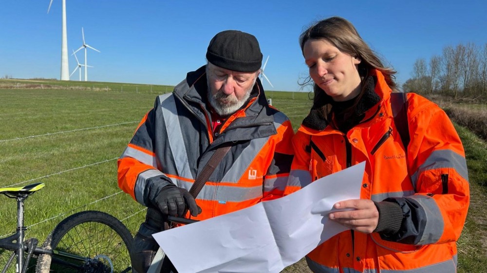
Camille Colinet and Philippe Taildon have arranged to meet us in the Beloeil region. "So, today's program... According to my map... We're doing a Ramegnies-Wadelincourt-Ramegnies loop. Does that suit you, Camille?" Their duo have already covered hundreds of kilometers in Hainaut, scouting out hiking routes. "With colleagues at the office, we've mapped out a pre-network, for the Henriette project. We have maps. But now we have to compare these maps with the reality on the ground". Comparing means first of all checking the accessibility of the site. There are regularly inconsistencies between what the maps say and what Camille and Philippe discover.
"Look here: we're supposed to be on a dirt road. We're not! It's concrete. And the path here on the left doesn't even exist on the map. Sometimes, the path has become impassable over time, worn down by tractor wheels or overgrown with vegetation. Local residents may also have made it their own. "Fake private property," exclaims Camille. "Sometimes you get the impression that people have taken a blank sheet of paper, written 'private property' on it in red and bang! We can't get through". The provincial agents don't play policeman. But they do take note, photograph a lot, and will question certain communes. "To ask them, for example, if it isn't possible to rehabilitate certain stretches, or to check whether it's really private property, etc.".
During their peregrinations, the two partners also study the tourist interest of the routes. "The aim is to have a network of the highest possible quality," Camille continues. "We also go out into the field for this reason: to realize the attractiveness of this or that itinerary. It's not unusual for us to decide to modify a route, so that hikers can pass an interesting place, from a heritage point of view. Or because in the small village, there's a shop set up one street away, and this shop will be able to allow tourists to stock up". "We really have to think like hikers, put ourselves in their shoes", Philippe sums up. In a few months' time, he'll be retired. "I'm lucky to end my career like this," he smiles. It's a particularly mild day for scouting. "We've got glorious sunshine, it's perfect! But it's not always like this. In Belgium, we have to get used to hiking in all weathers!". They spotted the Hauts-Pays in the middle of a heatwave. Philippe covered a few sections in the snow. "There are rainy days, too, that's just the way it is! But despite everything... I don't think we'd give our place to anyone else!".
Their favorites so far? "Philippe advises us: "Aubechies and the surrounding area are superb. Camille has fallen for Wiers, "a village I didn't know at all! But it's got everything you need for hiking".
The scouting is coming to an end. Soon comes the "staking" stage: "this consists of looking on the map where we can place the posts and markers". Eventually, the idea is to be able to suggest ready-to-use themed walks to walkers. But also to enable them to plan their own hikes, by easily spotting the route and noting the markers to follow. The same thing, then, as the "bike node" system, but this time for pedestrians!
Source: www.rtbf.be/